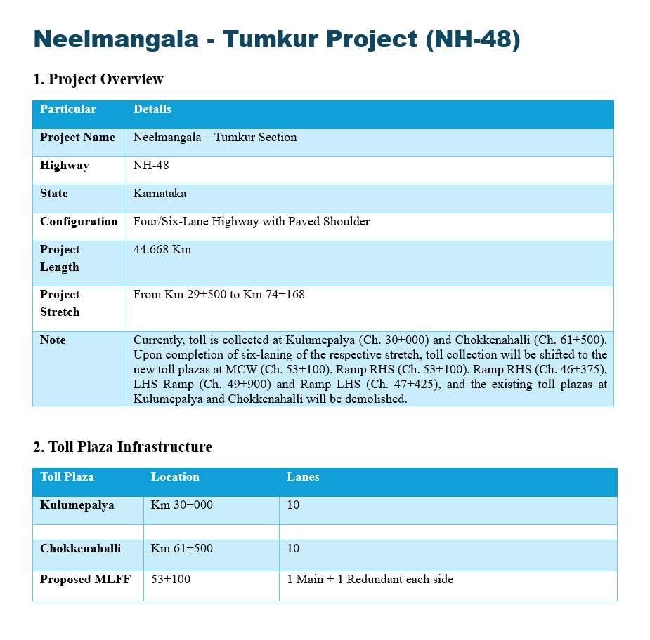
Neelmangala – Tumkur Project Summary
The Neelmangala – Tumkur Project, officially designated as the Neelmangala – Tumkur Section, is an essential highway development located in the state of Karnataka. Developed along the NH-48 corridor, this roadway features a Four/Six-Lane Highway with a Paved Shoulder configuration. The total project length covers 44.668 kilometers, spanning a specific stretch that begins at Km 29+500 and runs through to Km 74+168, providing a major high-capacity traffic route for the region.
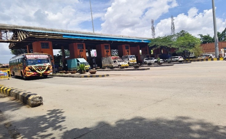
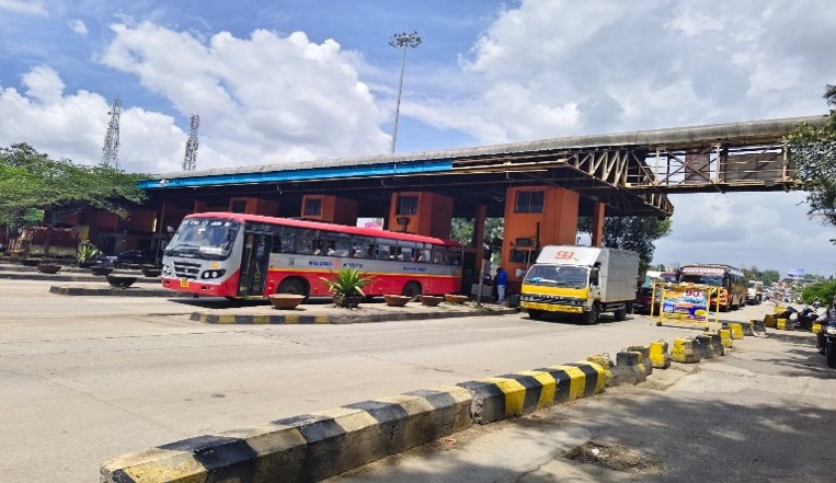
Currently, toll collection along this corridor is active at two primary locations: the Kulumepalya Toll Plaza at Km 30+000 and the Chokkenahalli Toll Plaza at Km 61+500, both of which operate with a 10-lane setup. To upgrade infrastructure and efficiency, a clear transition plan is in place. Upon the completion of the six-laning of the respective stretch, the existing Kulumepalya and Chokkenahalli plazas will be demolished.
Toll collection will then permanently shift to a series of newly established toll plazas. These upcoming plazas will be positioned at MCW (Ch. 53+100), Ramp RHS (Ch. 53+100), Ramp RHS (Ch. 46+375), LHS Ramp (Ch. 49+900), and Ramp LHS (Ch. 47+425). Additionally, the modern infrastructure plan includes a Proposed MLFF (Multi-Lane Free Flow) system at location 53+100, which will feature 1 Main and 1 Redundant lane on each side to ensure streamlined, continuous vehicle processing.