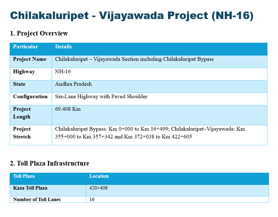
The Chilakaluripet – Vijayawada Project, officially designated as the Chilakaluripet – Vijayawada Section including Chilakaluripet Bypass, is a prominent highway infrastructure development situated in the state of Andhra Pradesh. Developed along the NH-16 national highway corridor, this modern roadway is engineered to a high-capacity Six-Lane Highway with Paved Shoulder configuration. The entire project covers an extensive total length of 69.408 kilometers, significantly boosting regional logistics and transit efficiency.
The project stretch is systematically split into distinct sections to seamlessly handle both local bypass traffic and long-distance commercial freight. It includes the dedicated Chilakaluripet Bypass, which spans from Km 0+000 to Km 16+499. The main Chilakaluripet–Vijayawada highway stretch encompasses two key operational segments: the first running from Km 355+000 to Km 357+342, and the second continuing from Km 372+038 to Km 422+605.
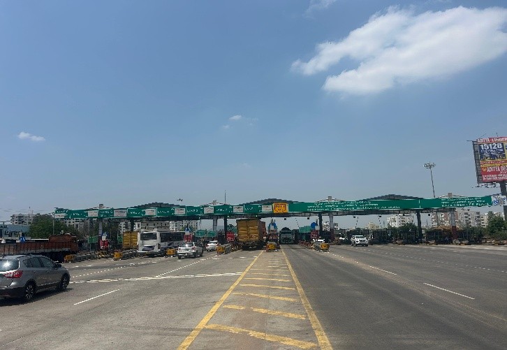
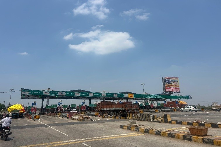
To manage the vast traffic volumes traversing this major economic corridor, the project integrates a robust tolling infrastructure. Toll collection is centrally managed at the Kaza Toll Plaza, which is strategically located at chainage 420+408. To maintain optimal vehicle throughput and minimize transit delays, this facility features an expansive configuration with a total Number of Toll Lanes specified at 16.